Singapore POST

Old Maps of Singapore

Issue date 26 Jul 1989

Overview

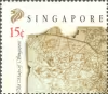
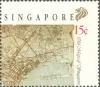
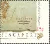
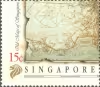
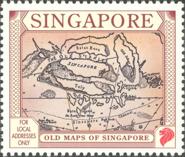
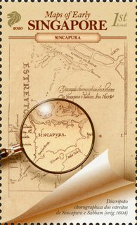
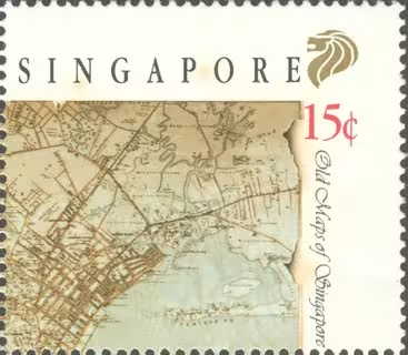
The island of Singapore was featured in the early South East Asia map even before its founding as a modern commercial entreport port in the 19th Century. Sketches by Chinese and Portuguese traders trom the 16th Century showed the island located strategicaily at the tip of Malay archipelago, and fronting the stretch of sheltered waterways known today as the Keppel Harbour.

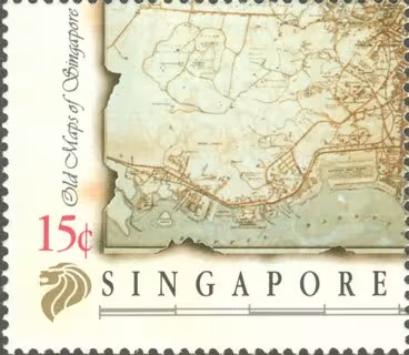
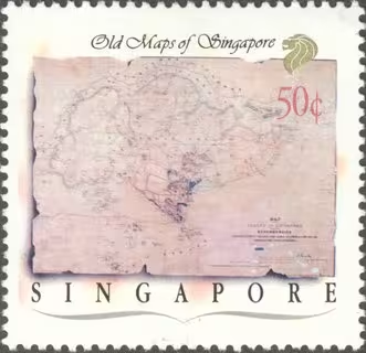
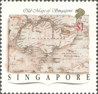
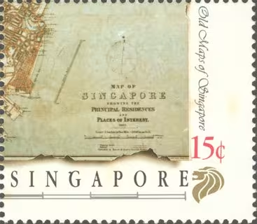
With the establishment of Singapore as East India Company's trading port in 1819 by Stamford Raffles, maps began to be made of the island in greater detail. In the first few years, marine charts were produced for navigation purposes. Subsequent maps of the 1820s were topographical surveys made for revenue purposes. Of greater significance in the course of the next few decades were the extensive surveys on the interiors of the island as well as the sectional maps of the town area, incorporating proposed plans for administrative projects, building of roads and allocation of land for ethnic groupings,

Maps and charts were initially done on a part-time basis by military engineers as part of their surveys of the island and its surrounding waters. In 1827, GD Coleman was employed as the first official Revenue Surveyor, with duties to prepare land titles for the Singapore Town. Other prominent government surveyors in the 19th Century included It jackson, Thomson, J B Tasin. J C Woods, C E McCallum and D Quinton.

The first maps of the Singapore island were hand drawn pieces, and many original manuscripts were mounted on canvas to preserve their usage. Subsequent prints made from these manuscripts survive the century. A range of the early maps of Singapore is preserved today mainly in the collections of the National Museum, and in the reference section of the National Library and Archives.
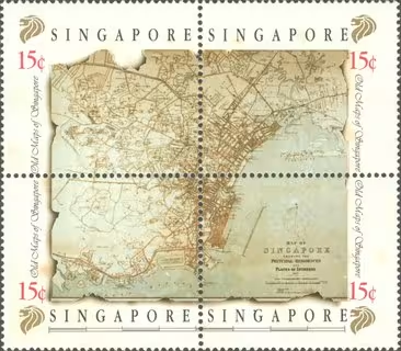
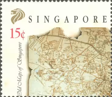
Old Maps of Singapore
Technical specifications
Denomination4x15¢, 50¢, $1
Stamp Size38mm x 33.3mm (15¢), 38.1mm x 36.9mm (50¢, $1)
Perforation14 (15¢), 12½ x 13 (50¢, $1)
PrintingLithography
Sheet Content40 stamps per sheet (15¢), 50 stamps per sheet (50¢ & $1)
PrinterHarrison & Sons Limited
Graphic DesignerLeo Teck Chong
Singapore POST
Singapore POST
Singapore POST
Singapore POST
Singapore POST
Singapore POST
Singapore POST

Old Maps of Singapore

Issue date 26 Jul 1989

The island of Singapore was featured in the early South East Asia map even before its founding as a modern commercial entreport port in the 19th Century. Sketches by Chinese and Portuguese traders trom the 16th Century showed the island located strategicaily at the tip of Malay archipelago, and fronting the stretch of sheltered waterways known today as the Keppel Harbour.

With the establishment of Singapore as East India Company's trading port in 1819 by Stamford Raffles, maps began to be made of the island in greater detail. In the first few years, marine charts were produced for navigation purposes. Subsequent maps of the 1820s were topographical surveys made for revenue purposes. Of greater significance in the course of the next few decades were the extensive surveys on the interiors of the island as well as the sectional maps of the town area, incorporating proposed plans for administrative projects, building of roads and allocation of land for ethnic groupings,

Maps and charts were initially done on a part-time basis by military engineers as part of their surveys of the island and its surrounding waters. In 1827, GD Coleman was employed as the first official Revenue Surveyor, with duties to prepare land titles for the Singapore Town. Other prominent government surveyors in the 19th Century included It jackson, Thomson, J B Tasin. J C Woods, C E McCallum and D Quinton.

The first maps of the Singapore island were hand drawn pieces, and many original manuscripts were mounted on canvas to preserve their usage. Subsequent prints made from these manuscripts survive the century. A range of the early maps of Singapore is preserved today mainly in the collections of the National Museum, and in the reference section of the National Library and Archives.
Denomination

4x15¢, 50¢, $1

Stamp Size

38mm x 33.3mm (15¢), 38.1mm x 36.9mm (50¢, $1)

Perforation

14 (15¢), 12½ x 13 (50¢, $1)

Printing

Lithography

Sheet Content

40 stamps per sheet (15¢), 50 stamps per sheet (50¢ & $1)

Printer

Harrison & Sons Limited

Graphic Designer

Leo Teck Chong

Old Maps of Singapore

Issue date 26 Jul 1989

Old Maps of SingaporeOld Maps of SingaporeOld Maps of SingaporeOld Maps of SingaporeOld Maps of SingaporeOld Maps of SingaporeOld Maps of Singapore

Overview

The island of Singapore was featured in the early South East Asia map even before its founding as a modern commercial entreport port in the 19th Century. Sketches by Chinese and Portuguese traders trom the 16th Century showed the island located strategicaily at the tip of Malay archipelago, and fronting the stretch of sheltered waterways known today as the Keppel Harbour.

With the establishment of Singapore as East India Company's trading port in 1819 by Stamford Raffles, maps began to be made of the island in greater detail. In the first few years, marine charts were produced for navigation purposes. Subsequent maps of the 1820s were topographical surveys made for revenue purposes. Of greater significance in the course of the next few decades were the extensive surveys on the interiors of the island as well as the sectional maps of the town area, incorporating proposed plans for administrative projects, building of roads and allocation of land for ethnic groupings,

Maps and charts were initially done on a part-time basis by military engineers as part of their surveys of the island and its surrounding waters. In 1827, GD Coleman was employed as the first official Revenue Surveyor, with duties to prepare land titles for the Singapore Town. Other prominent government surveyors in the 19th Century included It jackson, Thomson, J B Tasin. J C Woods, C E McCallum and D Quinton.

The first maps of the Singapore island were hand drawn pieces, and many original manuscripts were mounted on canvas to preserve their usage. Subsequent prints made from these manuscripts survive the century. A range of the early maps of Singapore is preserved today mainly in the collections of the National Museum, and in the reference section of the National Library and Archives.
Technical specifications

Denomination4x15¢, 50¢, $1
Stamp Size38mm x 33.3mm (15¢), 38.1mm x 36.9mm (50¢, $1)
Perforation14 (15¢), 12½ x 13 (50¢, $1)
PrintingLithography
Sheet Content40 stamps per sheet (15¢), 50 stamps per sheet (50¢ & $1)
PrinterHarrison & Sons Limited
Graphic DesignerLeo Teck Chong
Subscribe to newsletter

Stay updated

Subscribe to our newsletter for the latest stamp releases, behind-the-scenes features, and exclusive stories from the vibrant world of philately.